A trip report of my tour of Auckland’s volcanoes on February 4th, 2020… continued from Part 1!
Volcano 6: Lake Pupuke
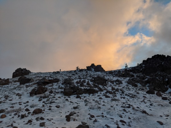
After lunch, it was time to leave “south” Auckland, where Mike and I had completed the standard tourist circuit, and cross the Auckland Harbor Bridge to Auckland’s North Shore. Our first stop: Lake Pupuke.

At first glance, this lake didn’t look too special. It wasn’t even particularly big, measuring about 4.5km in circumference (even less than my local lake, Lake Merritt!), though it certainly looked deep (it reaches 57m in depth!).
But of course, since this was a volcanic tour, it turned out that this was also a volcanic crater. Just one now filled with water. (In fact, it’s Auckland’s only volcanic crater lake, or maar!)
Though I couldn’t really tell from the vantage point of the southern pier (and because of the water), there were apparently two craters here. One big one, forming most of the lake, and one smaller one to the northeast, not too far (apparently less than 200m at one point) from the ocean.


According to Mike, this lake isn’t as high as it used to be (even within his lifetime, it seems). “There’re no creeks or tributaries to this lake,” he explained. “This lake gets its water from rainfall. There hasn’t been as much rain.”
As he said this, I wondered how much of a role climate change played.
With all that said, the lake apparently used to be even higher! Up until 1944, water from this lake was used as a freshwater source for Auckland.
This was evidenced by the unmistakable pumphouse nearby. As I learned from Mike and some signs outside, this pumphouse fell into disrepair after it was decommissioned. But, as it was readied for demolition in the 1960’s, “art lovers and history buffs” raised funds for it to be rescued and converted into a theater with an outdoor amphitheater.

As Mike asked me how to say a few phrases (like “volcano”) in Mandarin Chinese (he was interested in expanding his market), we took a few photos from the pier, watched a group of young adults cannonball off into the lake, and briefly said hi to the older lady and gentlemen behind the PumpHouse Theatre ticket booth counter.
Then we left for the nearby Takapuna Beach.

Takapuna Beach


The plan for Takapuna Beach was to walk from one end to the other. “There’re some cool volcano-related features I want to show you!” Mike said.
As far as I could tell, though, the only volcano I could see was Rangitoto, albeit now from a more northerly angle.


“Check out these cracks!”
I looked. Some were deep and narrow. Others were shallower, but wider. All of them had water running through them.


“Where do you think this water comes from? There aren’t any streams or rivers nearby here.“
“The Lake?”
“That’s right! There’re cracks in the volcanic crater under Lake Pupuke. Freshwater from the lake squeezes out through these underground channels.”
After cracks came holes. Some big. Some small.
“What do you think this is?”


I don’t remember what my answer was, but, as with many of Mike’s questions, I’m pretty sure I got it wrong.
“They’re fossilized trees. Or fossilized evidence of trees here as lava flowed down to this beach and cooled.”
After examining a few of these also-volcano-related-but-not-crater holes, we continued down to a denser residential area (or at least where houses actually met the water).

Now, there were holes not only in the ground, but on the walls too.
“What do you think these holes are?”


I could tell it was volcano-related. But, if I had come out here on my own, I probably would’ve walked right by these myriad holes without noticing them.
“They’re lava tubes! They’re formed when the outer part of slowly-moving lava flow cools and hardens, while leaving a stream of lava flowing inside. Some can be so big that you can walk in them. Māori have used them in ambushes in the past!”


Presently, we reached the end of the rocks. A roadside cafe appeared; the beach continued to stretch out farther, but now it was a more “standard” sandy beach.
“This is where I leave you.”
I turned to Mike and asked him what he meant.
“I mean, I’m going to get the car. Now, you have two options: stay here at the cafe, and I’ll meet you here. Or walk down to the end of the beach, and I’ll meet you there!”


I opted to take a walk. It was hot, and the beach was exposed… but why would I give up a chance to see more of New Zealand?
As I strolled down the beach, I soon noticed a collection of brightly colored kayaks. Followed by a signs indicating some kind of race.
“There can’t be a race now!” I thought. After all, it was a hot Tuesday afternoon.


But lo, not soon after I passed the kayaks, I heard a man yell in my direction: “Are you a runner? You look like a runner!”
Indeed, I was wearing a hydration vest, and partly because it was so warm, and partly because almost all the clothes I had packed were for running and cycling, I was essentially wearing running clothes. In any case, I was pleased to be identified “as a runner,” and I headed over to the man… who just happened to be in a tent… which just happened to be next to what looked like a starting corral?


“Is there a race happening today?” I asked incredulously.
“There is! You can swim, paddle or run! Or all three!” someone in the tent answered.
“When does it start?”
“Six.”
I checked my watch. It was 4:30. Mike and I had one more stop to go. I wouldn’t make it back in time.
Realizing this, one part of me wanted to just drop everything and tell Mike that I’d want to skip our next stop so I could participate in this race… but another part of me reasoned: “Not so fast, you’ve got a 102K in 4 days! Don’t waste your legs here on the beach.”
I snapped a few photos of the course maps and info wistfully, headed to the end of the beach, and told Mike (after getting into his thankfully well-air-conditioned car) about the race.
“We don’t have to go to North Head, you know. We could just come back before 6. Just let me know — now or never!”
I was a little sad, but decisive. Time to check out North Head… to me, Auckland’s version of Marin’s fortifications (San Francisco’s historic seaside, hillside military guns and bunkers)! Our second-to-last stop.
Volcano 7: North Head / Maungauika

Perhaps the most visible feature from North Head was its view over the Hauraki Gulf, with its various beaches and harbors, as well as Auckland’s central business district.
The second most visible feature, of course, was its military history. Similar to many other coastal cities, gun and bunker emplacements were built here for defense. In Auckland’s case, these defensive installations just happened to be on a volcano near the quite-gentrified Devonport neighborhood.


Unlike other coastal bunkers I’ve seen, though, this one had disappearing guns! A North Battery over Rangitoto Channel, a South Battery facing the inner harbor, and a Summit/Cautley Battery on top of the volcanic hill itself. I only visited the South Battery while I was there.


These guns were built in 1885 during the Russian scare. “They were state-of-the-art for their time,” Mike told me. “They’d fire, and the recoil from refiring would retract the gun back into the bunker, hence their name: ‘disappearing gun.’ Invading ships wouldn’t be able to see where they were being shot from!”


“The only times they’ve ever been fired was for practice, though. I think these were sold and built to make someone a lot of money.”
After explaining how the guns became obsolete with the advent of airplanes, radar detection, and guns that could fire much faster we explored surrounding tunnels.
One tunnel led to a cave with walls that had been made from layers of ash.

Others led to rooms where explosives and ammunition had been stored. In one passageway, there was a window into a room where a lamp would be lit; there was a separate passageway around the back to get to that room. It was too dangerous to have an open flame otherwise.


As we left, Mike pointed out a sizable rock. “I’m glad they haven’t removed all these rocks. These were rocks that flew out of the volcano when it erupted. Imagine if there was an eruption today, and rocks this size are thrown around.” With that thought, we left for Mount Victoria.


Volcano 8: Mount Victoria / Takarunga
As we drove to the nearby Mount Victoria, Mike turned to me and asked: “Do you want to drive up this mountain, or do you want to walk?”
It was getting late into the day. Mike explained that a lot of people often get too tired for this last walk. But he thought that I was young and fit enough to keep going. I was in fact getting a little tired, but not nearly enough to stop just yet.
We proceeded to hike.

The first (and only) real notable feature on this hike up was this “writer’s residence.” Unfortunately, I don’t remember much about this house, but apparently some famous authors have lived and worked here before. Mike didn’t give me much time to read the signs, but my impression was that it was still an active residence. In fact, as Mike mentioned it to me, a couple local women walking down the road from the summit, remarked that they hadn’t realized the significance of this building before.

Overall, though this particular volcano was the tallest on Auckland’s North Shore, and named in Māori as “the hill standing above,” it wasn’t really that high, at 87 meters. So Mike and I made it up to the top pretty quickly (though we did take a steeper shortcut via some stairs versus following the road the whole way).
At the top, there was some kind of signal station (there weren’t any interpretative signs explaining what it did), some great views of the Waitematā Harbor and Hauraki Gulf, and this field of mushrooms.

These “mushrooms” reminded me of Mario (those “power-up” mushrooms). “They’re vents for water pumps here,” Mike told me.
Of course, since this was also high place next to the ocean, there was also a disappearing gun emplacement here.

But what interested me the most was a miniature map of Auckland’s surround area.

The map even had a little arrow pointing to Devonport, where we were. I also liked the little bridges.

Finally, after admiring the view one last time, it was time for the tour to end. Mike asked me if I wanted him to drop me off at the Devonport ferry, to be ferried back to Auckland. “There’s going to be a lot of traffic on the way back,” he warned.
I’m sure the ferry would’ve been nice, but I also didn’t really want to wait around for it (despite Mike assuring me that it “leaves every 15 minutes”) and I’ve had enough ferry rides in my life. So I opted for a ride back, during which Mike (probably) asked me more about AI (we started talking about it even at the beginning of this trip), I learned more about Mike’s tour business, and I learned more about Auckland.
As he dropped me off back near the Ferry Building, I was glad I got to see so much in one day. When I had told Jenny (a local New Zealander runner who I had met in Berkeley, and who I’d be spending time with in Rotorua) my itinerary for today, she thought it was ambitious. Now that it was over, frankly, I thought it was actually very well-paced, money well-spent, and a terrific scenic and learning experience overall.
Now it was time to start cycling (to be continued!).

One Comment