After this trip — the second in two weeks — I told a friend: “life is so boring now.”
I said this while realizing “wow, I get why people go on these epic runs every weekend.” It’s like a drug. There’s such an adrenaline rush scrambling, untethered, on rock. There’s such a sense of total calm while admiring miles of unbroken wilderness. There’s such a sense of life and purpose while moving through challenge after challenge.
I’m amused because, this time around, I thought I’d be more prepared for these challenges. During my first attempt at looping around Castle Peak via Carpenter Ridge, I almost “slipped off the side of the Earth” (as Lucas put it), relied almost solely on Lucas’s footprints for route-finding in the snow, and semi-zombie-walked the last several miles before calling it a day half-way into the Loop.
This time, I thought: surely I’ll be more sure-footed this time; surely, I’ll be able to hang on for the Full Loop this time…
Beginning the Longest Day of the Year
Before I begin, I should note that that this outing took 16.5 hours, and I ended with just under 36 miles. This entry is going to be a long one!
In my mind, there were multiple distinct parts to this trip. I’ve placed HTML anchors to each section:
5:22AM. The Inn at Truckee. Two weeks ago, we left Berkeley at 2AM, got to the Castle Peak Trailhead just before 5AM, and immediately got started. This time, we left Berkeley a day before, spent the night in Truckee, and left for the trailhead around 5:20. I even had cheap motel coffee!5:36AM. Castle Peak Trailhead. When we got the trailhead — one that felt familiar one now that I’ve seen it already — I was astonished by how little snow there was. Just two weeks ago, there was at least an inch of snow here, despite the relatively low altitude (~7200ft).5:50AM. Last time, it was Lucas, Nicole and me in our starting party. This time, Loren Lewis and Brady Burgess joined us. Despite both of them coming from the East Bay, I hadn’t met them before. But, it didn’t take long to see that I’d be the weakest link today.
Andesite Peak
5:54AM. “You added an extra mountain!” Here, we turned off the trail to bag Andesite Peak. According to Summit Post: “Situated very near Donner Summit on Hwy 80, Andesite Peak sees its fair share of visitors year round. The peak can be climbed by itself as a very easy outing from Castle Pass, or combined for a nice trifecta with nearby Castle and Basin Peaks. The most direct approach to the summit (from Castle Pass) is mostly on a very well maintained trail. The final 100 feet of climbing are off trail and involve some easy class 2 scrambling, but this can be easily negotiated by the most novice of hikers.”
Two weeks ago, this area was blanketed with snow. I didn’t realize there was an incline here and though that the sign here was much taller than it was! Incidentally, Google Maps calls this the Hole-in-the-Ground Trail Head. This was a bonus mountain “because it’s there.”6:02AM. Even from a moderate distance up this trail, I could see above the trees. Not sure which range/mountains those are in the distance, though.6:20AM. Easy scramble.6:22AM. Easy-ish scramble.6:23AM. Top of Andesite Peak.
Andesite: an extrusiveigneousvolcanic rock formed from molten magma, which has medium viscosity. The name ‘andesite’ is derived from a mountain range, the Andes in South America. These rocks are formed due to the constant subduction processes that lead to pushing of tectonic plates downward along the continental margins.
Also according to ScienceStruck, “its resistance to slip makes it very apt to be used in making tiles.” I guess these rocks were appropriately grippy6:24AM. Andesite Peak with a couple of Castle Peak’s “turrets” in the background.
Castle Peak Trail
6:30AM. At this time two weeks ago, sunlight filtered through a hazy sky to produce a pink vista. This time, the only thing I thought of was how it was already getting noticeably warmer!6:46 AM. At this time two weeks ago, on our way up to Castle Peak’s first turret, this path was totally invisible.6:48AM. Finally, at this time two weeks ago, Nicole and I almost went through this gap, after losing Lucas in the snow. Peering through the gap, though, the drop-off on the other side still seemed just as perilous!7:07AM. At high enough altitude, there was still snow. But it was clear that this was old snow — icy, hard, and dirty.7:09AM. Up and up.7:13AM. At this juncture, Loren left to run Carpenter Ridge (pictured behind me here) clockwise, like Lucas and I had done previously. The route that Brady, Lucas and I would do today would be counterclockwise.
Castle Peak Climb
After we bailed last time at Prosser Creek, I was a little disappointed that I didn’t really get to see Castle Peak. So I was pretty excited to really go over it this time! Little did I know…
7:19AM. On the map, there’s a trail that goes around/through the three Castle Peak turrets. This is the beginning of that trail. If I had been hiking solo, I would’ve questioned whether it was safe to proceed. But Lucas had already done this last week (and countless times before), and he led the way. If he could do it, then I could (probably) do it. The joys of having someone beta for you.7:21AM. Altitude: about 9080 ft. View at the top of turret 1. Lookin’ at turret 2.7:22AM. Yes, this was a run after all.7:23AM. Making my way down from Turret Numero Uno, with everyone else going up Numero Dos.7:24AM. Brady at the foot of Turret Dos, and me at the saddle point between Turret Uno and Turret Dos.7:25AM. There was no way we were going to climb up and over this turret (as opposed to the next one!). We had to go around.7:26AM. Nicole asked me for to send her this specific photo later. 🙂7:26AM. This was is actually quite passable. It’s still trail.7:27AM. Carpenter Valley from Castle Peak’s second turret.7:29AM. Still trail.7:31AM. Before making it to the final turret, Lucas asked all of us if we knew Sam Nickelson. Brady and I did.
“Well, his kids — 6 and 9 (I think?) — made it up to the top. So when we get to the climb, remember that those kids did it!”7:31AM. I had seen Sam’s photos of his kids’ climbing up, then downclimbing afterward. So I knew what this climb looked like.
But I still wasn’t ready! After letting Lucas, Nicole and Brady go ahead of me, I braced for the climb, knowing that falling would be not good. (My palms are getting sweaty typing this even now!)
In the end, Lucas made it to the top (of course). Nicole also made it to the top. Brady went up about 2/3’s of the way then declared that he had enough.
I wasn’t sure how far I wanted to go. I thought to myself: “If getting up to the top of this peak was point of this trip, then I’d go to the top 100%! But it’s not — making around the Loop is.” With that thought, halfway up the final summit block, I decided to climb down as well.7:37AM. To be honest, I probably could’ve climbed up all the way (I did want to see the official USGS marker after all). Positive hand and footholds were abundant; there were no loose rock here; and while I did have to use my arms at times, rest positions were plentiful.
But nerves got me. I really didn’t want to make a mistake and end this trip prematurely. I convinced myself that going to the top wasn’t worth it.7:39AM. Solid ground for a minute.7:40AM. There’s trail down the middle if you look closely!7:46AM. Runnable.7:46AM. Not runnable.7:50AM. I don’t think I’ve ever had the question “is this passable?” occur to me so often.7:50AM. Great views though!7:51AM. “This is the sketchiest part.”7:52AM. Both hands were needed here.7:55AM. I’m still surprised I managed to downclimb from the top of this wall with running shoes and no protection. This was maybe a little over 20 feet. Finding good holds and some smearing was the name of the game.7:55AM. A little moment of panic when I saw Nicole slip. Fortunately, this was more solid/flat ground.8:01AM. I was probably at the most risk on this traverse here. Instead of taking the shelf, I followed Nicole over the ledge about 20 feet above the shelf’s relative safety. Actually, because I was blindly following her beta, I hadn’t even seen the shelf. Only after I started getting stuck did I look over to see Lucas and Brady looking concerned. “I’d get down from there if I were you!” they said.8:03AM. More walkin’ along shelves.8:03AM. Going down. Fun’s almost over.8:04AM. Not great, not terrible. The worst was really all the loose rock. Surprisingly passable.8:06AM. A nice little downclimb, with a blind foothold, to end this set of climbs!8:08AM. Amusingly, throughout this little traverse of Castle Peak, Lucas kept saying “this is the sketchiest part.” He definitely said it often enough to make me wonder when this rocky section was all going to end (it definitely seemed to keep going!).8:14AM. After we were done, I was relieved that I had survived the most technical scrambling I’ve ever done. I felt accomplished. I was surprised at how mellow, and not-steep the eastern side of Castle Peak was.
I also knew that, now that we were on solid ground, it was time to run!
The Run Begins
8:15AM. Altitude: 8750ft. Just a little snow left, but pretty much easy going now!8:29AM. After 3 hours, we had (only) covered 6.5 miles. Brady later remarked: “I can’t believe how slow we’re going! But it makes sense.” (given how technical our route was).8:35AM. Frog Creek Overlook. When studying our route, I saw that our route came close to this Point of Interest (but didn’t actually include it). So when I made it up here, Lucas mentioned “well, this was unnecessary, but it’s so close!”8:35AM. A couple weeks ago, I carried sunscreen only not to use it at all (yes, I know you should still apply it when it’s cloudy/snowy). But today, it was clear that applying and re-applying was going to be the norm.8:40AM. Nicole left us at this juncture. (She had her own big adventure rivaling Lucas’s and my distance and vert from two weeks ago!)8:59AM. Last time, Lucas and I saw exactly two people on the trail: two mountain bikers at the very end. This time, there was a lot more traffic. This was partly because we were actually following a Real Trail™ for our first half, and probably partly because of the warmer weather.
Here, we continued eastward on Warren Lake Trail (AllTrails rates this as difficult? LOL) toward Summit Lake.9:07AM. One problem I experienced immediately into this trip were leaky HydraPak bite valves. I had bitten into both valves either hard enough, or long enough, to cause tears. This meant that even though the two HydraPaks I had were rated to carry 0.5L of water, I was in fact carrying less. One of the two leaked water more egregiously than the other.
This meant that I either had to drink more water to keep the reservoirs under less pressure (which would squeeze water out), or store less water overall.
This was fine last week, when I barely sweat. But now, four hours in, I had existed my first liter of water. At this point, Lucas had gone on ahead, and I asked Brady if we were close to Summit Lake.
According to Gaia, we were. But upon seeing running water, I decided that I couldn’t wait. Time to filter and top off. (Fortunately, I had brought my Katadyn BeFree water filter, which includes a 1L of capacity — this extra capacity definitely helped me out in the long run!)9:14AM. After filling up, it turned out that we weren’t far from Summit Lake after all. But personally, I prefer to get water from a source that’s already flowing (versus a stagnant/still lake). This was our our last water stop until Prosser Creek.9:16AM. Donner Lake Rim Trail!9:21AM. About 9.3 miles in (of 32). Lots of rolling dirt trail here, though mostly downhill. Very well-maintained. If we hadn’t just done Castle Peak, with Carpenter Ridge coming up, I probably would’ve hammered this section.9:38AM. There was supposed to be a bridge somewhere along this route. Instead of fording Prosser Creek, we’d cross the bridge through the valley and avoid getting our feet wet.
There were certainly a lot of little bridges, though, like one with this memorial here. As we continued, Lucas became increasingly concerned that this bridge might be gone.9:39AM. I wasn’t too worried. The trail was well-groomed. Running felt good. We were still miles away from where We Need To Commit, with more ups and downs to go. “Seems to be the theme today,” Brady said.9:47AM. With Donner Ridge to our right, we ran into a group of mountain bikers. They wanted to know how to get to Summit Lake.9:59AM. In trail running, people often say “hills pay the bills.” After all the downhill running, it was time to pay up — via the Drifter’s Hut Switchbacks.
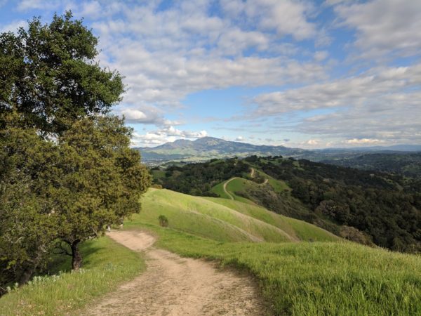
Looking at this view here, I wasn’t sure if the ridge in the distance was where we were going (I don’t think it is — we went farther!)10:18AM. 13.3mi, 7600ft. Finally, Drifter’s Hut — the top!10:28AM. Up and over.10:31AM. An avalanche warning sign on the left.10:38AM. Andromeda Trail. According to TrailForks, this trail is highly popular among mountain bikers (85/100) and runners (90/100).10:42AM.Hawk’s Peak!10:46AM.The actual climb to Hawk’s Peak according to TrailForks. Here, we met a couple hikers who warned us not to trespass through certain areas (“they have guns!”).11:08AM. After a whole bunch of switchbacks down Upper Mother Lode, I found myself in a clearing. There were A LOT of mountain bikers in the area. “It’s busy today!” I said.11:21AM. I’m always fascinated by trail names. These trails were no exception. After Mother Lode, we took Upper True Grit, followed by Sundance.
Because there were SO MANY trails here, though, Lucas took a wrong turn at Alder Creek Road. But Brady was quick to figure out that we needed to go straight, where we eventually went down Lion’s Leap (pictured above).11:46AM. The downhill run into the valley was exhilarating. It was the best downhill of this trip — not too steep, just technical enough to keep me on my toes (and not my butt or face), and straight with few switchbacks.
Lucas went ahead. Brady was second. I was the rear guard. But after a while, I ran into Brady, who had lost Lucas. We had missed a turn.
Fortunately, it was easy enough to backtrack. The idea was to meet at the bottom, at Carpenter Valley Road.
Surprisingly, instead of finding Lucas there, we arrived just in time to see Loren emerge from the opposite side of the road!11:46AM. Lucas, it seemed, also missed our intended turn. But he found us quickly enough after realizing that he simply needed to run down the road.
As he left, Loren told us that he had taken a spill while going down the nose of granite rocks (that we’d be going up later). Unfortunately, he broke his phone. Fortunately, he didn’t apparently break anything else (though later he mentioned lots of bruising on his chest, on Strava).
He also mentioned that he hadn’t refilled his water at the “mud pool” near Paradise Lake. Instead, he filled up right here, at Prosser Creek.11:51AM. Altitude: 6100ft. Prosser Creek was our Point of No Return, though no one mentioned it at the moment. Though we were halfway done (18 miles), my Garmin had only logged about 3300 ft of vertical gain. Our route called for a total of 9200! This was where the real climbing would begin.
Given how I was pretty much dead by this point two weeks ago, I was a little nervous about going another 18 miles (yes, it was 18 instead of 14 — as we found out from Loren) with some 6000 ft of vert. But I felt fine. Even if it wasn’t… well, I’d get through it. That’s what I told myself.
The Climbing Begins
1:13PM. Altitude: 7400ft. After crossing Prosser Creek, we went up Sage Trail to South Sagehen Creek Road, that I had walked down two weeks ago.. Seeing the trail and road again but going the other way, and in sunny weather, felt a bit surreal.1:15PM. The weirdest part was probably the ATV’s though.1:16PM. “Are you guys training for something?!”
“This. This is what we’re training for!” Brady replied.1:24PM.
The Off-Trail Begins
1:28PM. “Is it time?”
“Yup. Here’s we go up.”Check out those topo lines! (At least we went up the least steep section of the ridge.)1:34PM.2:00PM. Didn’t realize I was losing SO MUCH SALT. Check out those frosted eyebrows!2:18PM. Argghhhhh. Took this picture after taking a rest break.2:44PM. Argghhhhhhhh.2:55PM. ARGGHHHH. I’ve got to work on climbing up hills.3:02PM. Finally, I got up to the ridge.
Fortunately, Brady was waiting for me there. I asked him how he felt.
“I think I’m feeling the best I’ve felt all day.”
“Really??? I think there’s no running left in me.”
“Actually, I feel like running now!”3:24PM. 8740 feet. As I hiked up the incline, I periodically checked how much vert I was getting.
Embarrassingly, it was not much. Here’s the math: we went off-trail at 24.0 miles, 7120 feet. At this point, we had finished 27.8 miles. 8740 feet.
1620 feet of vert over 3.8 miles — or just over 8% average grade — isn’t anything to sneeze at. But it’s still considered (by some) to be runnable (albeit on trail or paved road). For example, VK races are over 25% grade (or the average black diamond ski run grade), and it’s possible to run a treadmill from 9% to 39%!3:25PM. As the Castle Peak came into full view (you can see a couple turrets here), Lucas asked me how I was feeling.
“50% zombie,” I said. “But that means I’m 50% NOT zombie.”
“If you want to turn back, I’ll go with you,” Brady offered. “This is the point of no return.”
In my mind, we had crossed that point a long time ago, at Prosser Creek. There was no point in turning back now (and in fact, it could be easier to continue from here, I thought).
“I’ve already seen this part,” I said. “So I know what’s coming.”
Obviously I was going to continue.3:38PM. The next peak to climb on the ridge.3:50PM.3:52PM. The route we were taking isn’t on any map. But sometimes natural trail can appear.3:53PM. The Carpenter Ridge summit log. Brady wrote our entry this time. No time to rest here for me.4:02PM. Beautiful. (Plus the next few peaks to go up and over.)4:04PM. I wish I had brought my GoPro for its wide angle (it’s stuck in my locked-down office).4:24PM.5:02PM. Scramble.5:10PM. Hike.5:24PM. Scramble.
A cord on my jacket got caught on a rock while I downclimbed this. I only noticed after I had dropped about 4 feet. It was unpleasant.5:34PM. Over a scraggly spire? Or go around?
Lucas went over. Brady and I scree-skiied around.5:40PM. A permanent change to the slope where we went down… (note the dirt patch).6:07PM. Incidentally, while I looked forward to seeing the spot where I freaked out last time (and thought I was going to slide 300 feet down a dirt slab), we went the “correct” route around it this time. So yes, while this section was a little scraggy, the route was obvious and relatively safe; no exposure this time.
The End of the Ridge (and Water), At Last!
I’ve neglected to mention two things thus far:
First, a few hours earlier, Brady noticed my discomfort at navigating steep, loose downhills. While confidence in my footing started out pretty high early in the day, some 8 hours of running and hiking really wore it down. “The area where I grew up had this kind of terrain — so I’m used to this,” he said. Then he offered me his trekking poles.
I have to admit that I’ve been a little too proud to use trekking poles before. “It’s a mechanical aid!” I’ve thought. “Only old or injured people need to use them.”
But, though I refused them earlier, I accepted his offer as the unrelenting up’s and down’s on the ridge got to me. They really helped (except on scrambles 😬)
Second, before we set off, I told Lucas that I was carrying much less food this time (~3600 calories vs ~5000 calories last time). He didn’t think it was a good idea. I thought that if I needed 200-300 calories per hour, then 3600 calories would be enough for 12 hours, 18 hours at most. I didn’t want to carry extra weight.
As we quickly approached the 12-hour mark with no end in sight, I realized I was both right and wrong. Right: I was carrying just enough calories.
Wrong: I was carrying just enough calories.
The problem with carrying just enough calories is that if you’re outside for longer than expected — or if you need more calories than expected — then you’re SOL. I only knew I actually had enough after I was done — and not when I was struggling halfway into the ridge.
Even worse, I thought that two liters of water would be enough to get me through the ridge. After crossing Prosser Creek at just over 18 miles, we knew that we wouldn’t have water until the end of the ridge, many afternoon hours later (though I found out later that Lucas was able to find and melt enough snow for his needs). But with leaky Hydrapaks and the hot sun bearing down on me, my water situation was not good by the time I had made it up to the top of the ridge (much less across it!).
Bottom line was, by the top I got to the top of Carpenter Ridge, thoughts of rationing both food and water were swimming in my mind, all while I grew weaker and weaker.
This didn’t escape Brady’s notice either, and he offered to share his water a few times.
When we got the antenna, I accepted his offer. By that point, I was nearly out of water; the extra half liter I got from him tasted like heaven. He also offered gels. After confirming that he had more than enough for himself, I accepted one (and at 150 calories, this extra gel gave me at least half an hour’s worth of extra energy!).
6:18PM. Despite getting some water from Brady, my water situation didn’t look good. But as we approached the end of Carpenter Ridge, the pond that I had sourced water from last time came into view. Sadly, it was as Loren had described: instead of containing clear snowmelt, it was now a mud pool. We’d have to drop down to Paradise Lake (on the left) for water this time.6:24PM. Paradise Lake. And the rocky ascent we’d need to climb to get back on to Castle Peak’s ridge!6:42PM. Getting down to Paradise Lake was easier said than done. While we had avoided bushwhacking for most of our run/hike up to this point, now we had to navigate through brush galore.7:11PM. As I got closer to the ascent, it started to look less scary. But now we were on the clock. There was no way the ascent would be safe after dark. We had about an hour until sunset.7:13PM. Water! At last! Despite the cloud of mosquitoes around my head and arms, I took the time to drink about 3 liters of water and fill up my 2L of capacity for the way back. As it cooled, I didn’t think I’d need that much water now. But then again, I knew there’d be no water sources until the very end (other than snow).
The Return
7:35PM. There are many things I would consider better than sex. These include (1) peeing after holding it in for a long period of time; (2) pooping after holding it in for a long period of time; and (3) drinking cool, fresh water after 12 hours of running and hiking in the sun.
With a belly full of (filtered) lake water, I felt like a new man. It was what I needed to start climbing again.7:39PM.7:42PM.7:44PM.7:47PM. “This was really the way we came down IN SNOW two weeks ago?”
“Yup!”
“Well, I’ll really have to trust my shoes here then!”7:53PM.7:55PM.8:25PM. At last, we finished climbing the nose, and just in time too! But in keeping with the day’s theme, there was still more climbing left — this time in snow.8:30PM. During our descent to Paradise Lake, Brady had found an alternate, easier route via the Pacific Crest Trail back to our trailhead. This was an option I could take if I was too worn out to head back up to Basin Peak and Castle Peak, as planned. “My day’s pretty much over,” I told him. I’d probably take the alternate route.
“We can decide when we get there,” he said.
Now, we were “there” and Brady suggested the idea.
I knew Lucas wouldn’t like it. This was the Castle Peak Loop! Yes, we started at the trailhead — but our day really began at Castle Peak. For him, the Loop could only be complete if he got back to Castle Peak.
As expected, Lucas wanted to complete the Loop. Brady was fine going either way. It was really my call.
The End
8:39PM. “I’m so sorry, Lucas. I’m going down.”
I really felt like crying. I was betraying the spirit of this trip. But there was no mistake: the sun had already set; there was only about half an hour of light left, and I would only slow our group down if I tried to climb back up to Basin and Castle Peaks.
“I’m going up. It’s so close; I’ve got to finish this,” Lucas said.
“I’ll head down with you,” Brady told me.9:11PM. This is the second time I’ve been on the Pacific Crest Trail (the first time being part of the John Muir Trail in Yosemite). Despite missing out on completing the Loop, I was quite happy with seeing this section of such a storied trail.9:12PM. One thing Lucas warned us about was the water. Because we were now in a valley, the melting snow meant that our trail would be wet. He was right.
Fortunately, these streams were barely ankle-deep.9:14PM. As we made our way to Castle Pass, where we’d regroup with Lucas, Brady noticed a tiny, moving light coming down Castle Peak. There was no question: it was definitely Lucas!9:31PM. Brady asked if I could run.
I still had some spurts of energy, but no, it wasn’t going to be enough to run the last few miles back to the trailhead.
That said, when we met up with Lucas at Castle Pass (apparently we all got there almost at the same time), I told them that I’d be perfectly fine to walk back. Here, there was no chance I’d get lost, and little chance of getting injured.10:07PM. As Brady and Lucas took off, I took inventory of my surroundings. The night sky was amazingly clear. I could hear babbling brooks close by, and in the distance. Though I had been beset by mosquitoes for hours, as we climbed up the nose to Castle Peak ridge, there were few critters bothering me now.
I was tired, my body creaked, and even as the trail sloped downhill, I couldn’t get myself to run. That said, walking felt good.
I was mostly alone, though incidentally, I noticed a truck and a tent about quarter a mile from the trailhead. I’ve tried to take a photo above (but obviously it’s not coming through). “Must be PCT thru-hikers,” I thought.10:12PM. As I stumbled into the trailhead, I heard whoops, hollering and music from Nicole’s car. She had gotten us all burgers; I couldn’t be happier.
“This was probably the hardest 35-miler you’ve ever done, huh?” Lucas said.
“Yeah, I’ve NEVER done so much vert in such short distance,” I replied.
“Huh. I guess I haven’t before, either!” Brady mused.
As I ate the cheeseburger, and later inspected my beaten-up feet, the day felt surreal. After our first “failed” Loop attempt, Lucas asked me if I’d do it again. I hesitated that first time.
But despite having to dig even deeper this time, there’d be no hesitation in answering that question a second time.