Distance: 16.45 mi
Vertical Gain: 3,675 ft
Elapsed Time: 4:48:21. Moving Time: 3:41:30
Trip Report
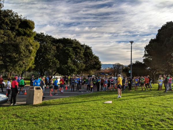
I’ve been thinking about exploring this corner of the East Bay Regional Park system for the longest time, and I’m thrilled to finally run it, and run it with the Beer Bucket Run crew! The long stretches of sun-exposed firetrails would definitely not have been as fun solo.

My group nailed every major labeled East Bay Park mining point of interest on the official brochure (except for Star Mine), and a few more beyond that too (this crew had the right balance of “what’s more to see beyond the end of the trail?” and “let’s keep moving.”)

In a nutshell: there were a lot of very family-friendly tunnels and mines — nothing like those in the Inyos and Death Valley where I’ve previously explored a number of abandoned mines with my friend Sean Goebel. So we got to see quite a few holes in the ground, including
- the well-known Prospect Tunnel, where we walked about 200ft to a locked gate (barring access to the remaining 200 feet);
- a stope where we peered down into the Hazel Atlas mine;
- several very securely locked air shafts; and
- “Jim’s Place”, a small shelter carved into the rock on Coal Canyon Trail.

I was a little disappointed but not surprised that much of the many townsites, e.g. all the old buildings, mining tools and equipment, were gone, except for the odd piece of rusted scrap metal, despite mentions of the three largest townsites, Nortonville, Stewartville, Somersville, in modern-day maps and street names (GhostTowns.com lists the the only remains of Somersville as “old boarded up mercury mines”). It seemed like the only thing left of note (other than the artifacts, buildings and mines officially restored by the Park Service) was the Rose Hill cemetery. I guess this area was accessible enough for the mining companies to salvage their stuff, and anything left was probably stolen.


Still, there were many interpretative signs with photos of buildings that used to pepper the landscape, and I took the group on several miner trails (at least the officially marked ones).
Temps cooperated in the morning. But it quickly got warm by early afternoon. I was somewhat toasted by the end, though it never got bad (despite my watch and later, Joe’s car, showing 90+ degrees F). I was VERY happy that I had drew the route that I did, with water at Mile 10, because that’s where virtually everyone needed water, including me. The rest of the park was just parched except standing pools of muddy algae: the map shows lots of creeks in this park, but they’re clearly seasonal (which I expected coming in).


While at the cemetery, I looked for a “Mary Norton” but couldn’t find her. As it turns out, it was Sara Norton I was looking for (I had the “two witches of Black Diamond Mines” mixed up, the other one being Mary the White Witch, hanged in the 1870’s.), and I did in fact see Sarah’s tombstone. Apparently, she still haunts the area. But I observed no paranormal activity while Amos, Joe and I were there.

From patch.com:
The White Witches of the Black Diamond Mines
The spirits of Sarah Norton and another woman named Mary are said to lurk, haunting those who encounter them.
Norton, who was buried in the cemetery, was a midwife to the townsfolk. According to a park brochure, she was a widow who married Noah Norton, for whom the town of Nortonville was named. But she suffered a tragic death when, as she was answering a call for service in the neighboring town of Clayton, she was thrown from a buggy and was instantly killed.
According to one report by Live 105: “Sarah was not a religious woman and had told her kids that she did not want a funeral, but when she died the townspeople of Somersville wanted to give her one. On the day of the funeral a fierce storm struck up and caused them to delay it until the next day. That following day another storm came out of nowhere and the livestock started charging through town, at that point the townspeople stopped trying to give her a funeral and just brought her to Rosehill Cemetery. From that day her spirit has been seen around Somersville and the other locations where the mining towns use to be. She has reportedly been seen in the graveyard floating around the tombstones.
Had a lot of fun, and now I have more ideas about routes that could connect this park with Diablo!
Planning The Routes

Because I was the host for this Beer Bucket Run group trail run, I drew three routes, per tradition: a short, medium, and long route. And given our previous conventions, I tried to stay within our conventional distances and vertical gain. This resulted in an
- an 8.6mi, 2100ft short route: https://www.strava.com/routes/3256864053108775432
- a 12.4mi, 2800ft medium route: https://www.strava.com/routes/3256862028448559186
- a 16.0mi, 3700ft long route: https://www.strava.com/routes/3255368612749772536
My hope was that while everyone would choose the long route, folks could decide at around 3 miles whether to cut off toward the main Great House Visitors Center or peel off back to our start/end at the entrance parking lot at around 10 miles, if they wanted or needed to.
Water was also a consideration as well, and fortunately everyone who showed up had the good sense to bring their hydration vests and sufficient capacity. Though my research showed various creeks around the park, I was pretty sure (and later confirmed in-person) that these were all seasonal, and therefore dry by this time of year. The only water we got, therefore, was at the Great House Visitors Center at Mile 10 (where Beko, Ethan, and Yoyo peeled off for the Medium route). There was also a water fountain there… but the the water there tasted so moldy that I had to force myself to swallow it quickly and ignore the terrible aftertaste.

Future Runs
After I got home and posted this run to Strava and Instagram, a number of friends, and friends of friends, commented on how they had no idea that this area existed in the Bay Area (just over an hour from San Francisco and 45 minutes from Oakland!).
Personally, this area only came to my attention during 2020 or 2021, when I looked for permits and events held by the East Bay Park District: it turns out that tours of the mines here are quite popular!
Since then, I noticed that while I’ve run much of the west and south sides of Mount Diablo, including the Diablo Foothills and Shell Ridge, I haven’t seen much of its north and east sides — including Black Diamond Mines.
Now that I’ve run this, it’s likely that I’ll make use of the various Clayton-to-Black Diamond and Diablo-BD connector trails. Some ideas include
- The 35-mile Antioch to Walnut Creek section of the American Discovery Trail: “A series of trails (Stewartville, Ridge, Nortonville, Black Diamond, Cumberland, Bruce Lee, Corral Road, Mitchell Canyon, Meridian Ridge, Deer Flat Creek, Prospectors Gap, North Peak, and Summit) take the ADT through the Black Diamond Mines Regional Preserve, through the city of Clayton, and up the north slope of Mt. Diablo to the 3,849 foot high summit… Five small coal mining towns thrived in the Black Diamond area from the 1860s through the turn of the century…”
- Linking up some of the peaks and ridgelines of BD Park, including Rose Hill peak.
- A possible linkup through Morgan Territory and Round Valley?
Fin.

